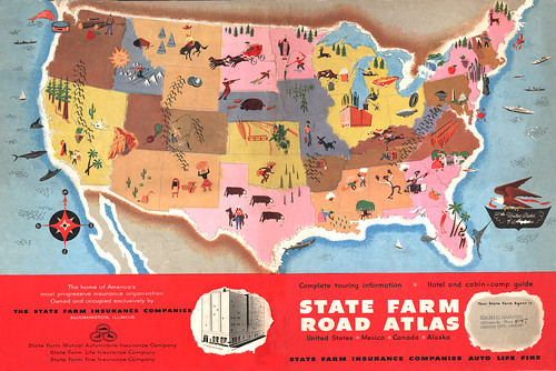
This is a huge State Farm Road Atlas from 1950. No mention of illustrator. It took six scans and lots of photoshopping to put it all together and get rid of all the scratches and torn areas. It was in pretty bad shape, but now you can enjoy it looking as close to what it's supposed to look like back in the day.
Click here to view larger.
Hope you stay safe in your travels this Holiday Season!

lol. Pennsylvania just has a pile of coal. Still, better than what's going on in Alabama and Mississippi, Cripes!
ReplyDeleteI grew up with this atlas next to my grandma's fireplace. I looked at it a lot over the course of my childhood. It's a fascinating image. And it made U.S. travel seem so friendly and interesting and welcoming, and made perfect sense with the architecture and decor of all the rest area shelters and midcentury burger and ice cream stops where we used to eat along the way, holdovers from 20 years before. When I went on road trips as a kid (the 70s), particularly with my grandma, this was the image that oriented me.
ReplyDeleteI love these maps
ReplyDelete